Historic Area Commission Standards & Guidelines Update
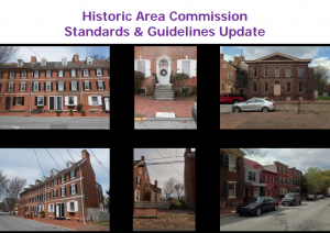
City Council appointed a Historic Area Review Committee to review the Historic Area design guidelines and permit application review process. Below is the Historic Area Commission Standards & Guidelines Update presented at the June 30, 2015 Special City Council Meeting.
Welcome to the City of New Castle
Step back in time and experience the charm and beauty of colonial New Castle. Walk the cobblestone streets and enjoy the historic sites of this riverfront community.
Historic New Castle, Delaware is located just 10 minutes south of downtown Wilmington with easy access from I-95 and I-295. Overlooking the Delaware River, Historic New Castle is the oldest continuously occupied town in the Delaware Valley. And, thanks to preservation efforts, this vibrant, fully occupied community remains one of the most important Colonial/Federal villages in America – second only to Williamsburg, Virginia in the number and authenticity of its historic structures. The New Castle Court House Museum is part of the the First State National Historical Park.
New Castle, originally named Fort Casimir, was founded in 1651 by Peter Stuyvesant, who was sent to provide the Dutch with command of all river traffic. Because of its strategic location, ownership of the settlement was constantly changing. The flags of the Netherlands, Sweden and Great Britain have all flown over New Castle.
The three counties which make up the state of Delaware were added to William Penn’s lands in America. In 1682, Penn came ashore at New Castle and took possession, but these counties, which were well established, became dissatisfied with Penn’s rule. In 1704, when he granted them a separate legislature, New Castle became the colonial capitol of Delaware. The lively town also briefly served as the first state capital, and continued as the county seat until the 1880’s.
New Castle’s location made it an ideal transfer point for trips up and down the coast. As a result, New Castle was a thriving community throughout the 1700’s and early 1800’s. The courts and general assembly also attracted various judges, lawyers and government officials who built handsome houses, many of which still remain. The Great Fire of 1824, which started in the stables behind the Jefferson House, claimed many of the inns and warehouses located on The Strand. Among the buildings destroyed was the modest home of George Read, signer of the Declaration on Independence and the Constitution.
Unlike many historic communities, New Castle is a residential town where people live and work. Each house reflects the individuality of its past and present owners. Because New Castle has been named a National Landmark Historic Area, all renovations and restorations are carefully supervised.
This small, picturesque City allows vacationers, as well as business travelers, a refreshing respite from the pressures of daily life. Whether you are enjoying the beaches, the Brandywine Valley, or other treasures of Delaware, be sure to include New Castle in your itinerary.
A timeline of New Castle City History, compiled by the New Castle Historical Society:
1651 – Fort Casimir established at today’s New Castle by the Dutch under Gov. Peter Stuyvesant.
1682 – William Penn landed in New Castle to take control of the colony of Pennsylvania.
1704 – Penn granted Lower Three Counties (today’s Delaware) independent status, with New Castle as their capital.
1764 – First Board of Trustees of New Castle Common named to manage common land for residents.
1776 – New Castle became the state capital, but the state moved its governmental seat to Dover the following year.
1824 – New Castle was devastated by the Great Fire on Water Street, now known as The Strand.
1831 – New Castle and Frenchtown Railroad opened. It was the first railroad in Delaware and one of the first in the nation.
1875 – New Castle incorporated as a city under an act of the state legislature.
1881 – New Castle County seat moved from New Castle to Wilmington.
1897 – Electric trolley service to Wilmington added.
1925 – New Castle-Pennsville, N.J., ferry service was inaugurated. It ended in 1951.
1934 – New Castle Historical Society established for purpose of opening the 1738 Amstel House as the first historic-house museum in town.
1949 – The town’s central district was surveyed and mapped by Historic New Castle Inc. in a preservation initiative.
2001 – The city celebrated the 350th anniversary of its founding.
Public Works Summer Hours effective Monday, May 11th

During the hot summer months Public Works labors start their day an hour earlier, to get a jump on the heat of the day. Public Works summer hours (6:00 a.m. to 2:30 p.m.) will begin on Monday, May 11th. They will begin their routes at 6:00 a.m. so plan accordingly to get your items out for pick up.
- Trash will be collected on Monday & Tuesday of each week.
- Yard Waste pick up will take place on Wednesday.
- Recyclable materials will be collected on Thursday & Friday of each week.
Street Sweeping will take place throughout the month, click below for easy to read printable calendar.
Printable May Street Sweeping Calendar
SUMMER START TIME 7:15 a.m.
*”Week” designation is by 1st, 2nd etc. “Full Week” of each month. Please see printable calendar.
*1st Monday (Even #’s) & Tuesday (Odd #’s) of each month.
7th, 8th, 9th, 10th, 11th, 12th, 13th, 14th Streets
Kings Way, Queens Court, Juniper Street, McIntyre Drive, Clayton Street, Young Street, School Street, Gray Street, Gray Court, Oak Street, Linden, Larkin and Hyder Alley.
*2nd Monday (Even #’s) & Tuesday (Odd #’s) of each month.
Dobbinsville
*2nd Wednesday (Even #’s) & Thursday (Odd #’s) of each month.
The Strand (Blower)
*3rd Monday (Even #’s) & Tuesday (Odd #’s) of each month
Boothhurst including Edgewood Drive in Rogers Manor
3rd Wednesday (Even #’s) & Thursday (Odd #’s) of each month.
Buttonwood, including Buttonwood Avenue, Arbutus, Meehan Lane, Lincoln Street, A Street, Railroad Avenue, Jacquette Square, William Penn Square, Holcomb Lane and Booker Circle.
*4th Monday (Even #’s) & Tuesday (Odd #’s) of each month.
Van Dyke Village, including 11th St, 14th St, Victorian Court, Swedes St, Baldt Avenue, Brylgon Avenue, Megginson Avenue, Hewlett Avenue, Janvier Avenue and Moore Avenue.
*4th Wednesday (Even #’s) & Thursday (Odd #’s) of each month.
2nd, 3rd, 4th, 5th, 6th, Cherry, Harmony, Chestnut, Tremont Streets, Deemer Place, Foundry, Shaw Alley, Williams, Plum Alley, Porter Alley, South Street and Delaware Street from 3rd to 7th.
Every Friday of each month
Delaware Street from 3rd to Wharf, both sides
Dalby Alley, First Friday of each month.
Some questions you may have:
Question: What if the weather is inclement and the sweeper cannot operate?
Answer: We will stick to the schedule, and on those days that the sweeper cannot operate due to inclement weather, a breakdown in machinery, or some other unforeseen incident, the street (or streets) scheduled for that day will be swept on the NEXT normally scheduled date.
Question: How will we be notified in advance that our street will not be swept?
Answer: An announcement will be posted on the City web site @ (www.newcastlecity.delaware.gov) by 7:15 am, advising of any day we need to cancel the service for that particular day. Or you can call the City’s message line @ 221- 4534 for recorded updates.
Question: What if a City holiday falls on my scheduled day?
Answer: The street (or streets) scheduled for that day will be swept on the NEXT normally scheduled date.
Trustees Community Grants and Scholarships
Trustees Community Grants and Scholarships
Trustees of New Castle Common
201 Delaware Street New Castle, DE 19720
Trustees Community Grants and Scholarships
The Trustees of New Castle Common annually award grants to community organizations and scholarships to eligible residents of the City of New Castle.
Application forms for this year’s grants and scholarships are available on the Trustee’s web site: http://trusteesncc.org or from the Trustees’ office.
Last year the Trustees budgeted $75,000 for scholarships and more than $200,000 for community grants. In addition to the forms,
the web site contains information on the allocation of Trust funds, properties, meeting minutes and the history and past projects of the Trust.
FEMA revising FIRMs; City properties impacted
Editor’s note: The following are edited excerpts from the FEMA Flood Hazard Mapping Fact Sheet prepared for New Castle County. This entire publication and a great deal of other detailed information, including draft maps, are available online at www.rampp-team.com/de.htm. (Note the map sections for the City of New Castle are numbered 0162, 0164 and 0166.)
FEMA manages the National Flood Insurance Program (NFIP). This Federal Government program makes flood insurance available to residents in communities which meet certain criteria, including the City of New Castle. Maps created by FEMA include the Special Flood Hazard Area, which is the area that has a 1% or greater chance of flooding in any given year.
When FEMA maps flood hazards in a community or county, two products are produced:
- a Flood Insurance Study (FIS) report; and
- a Flood Insurance Rate Map (FIRM)
An FIS is a narrative report of the community’s flood hazards that contains prior flooding information, descriptions of the flooding sources, information on flood protection measures and a description of the hydrologic and hydraulic methods used in the study.
A FIRM illustrates the extent of flood hazards in a community by depicting flood risk zones and the Special Flood Hazard Area, and is used with the FIS report to determine the floodplain development regulations that apply in each flood risk zone and who must buy flood insurance.
FIRMs for New Castle County are being revised using the latest technologies and the most current data so residents, homeowners, business owners and community officials may understand the local flood risk and keep people and property safe from floods.
Large printed color draft maps can be viewed at the Public Services Department at the Trolley Barn at 900 Wilmington Road. For more information go online to the above Web site, call the FEMA Map Information eXchange (FMIX) at 1-877-336-2627, or locally contact New Castle City Building Official Jeff Bergstrom at 322-9813.
As the City receives new information from FEMA, that will be publicized to City residents through this newsletter, the local newspaper and on the City Web site at newcastlecity.delaware.gov.
FEMA proposes changes for floodplain maps
This article from the News Journal (Gannett) delawareonline.com
New maps reflect greater flood threat
Written by Jeff Montgomery and Molly Murray The News Journal; Jan. 06
Several times a day lately, Sussex County official Jeff Shockley finds himself plunging into the fine points of flood plains, prompted by calls from residents anxious about big storms and bigger insurance bills.
“There’s been much more interest in the past couple of years, and I think that it’s due to the storms that have hit and missed all around us,” Shockley said. “I get several calls a day from homeowners wanting to know if their property is close to a flood plain, how close they are to a body of water.”
The latest surge in interest has coincided with the arrival of new Federal Emergency Management Agency flood insurance boundary maps, slated for public review in coming months. Driving the map revisions, federal and state officials said, is a need to improve badly outdated risk boundaries, reset minimum building heights and better inform residents and agencies about insurance and planning needs.
In tidal areas, the updates also reflect sea-level rise threats certain to grow in coming decades, officials have said.
The new flood-hazard outlooks are based on expected flooding during present-day storms with a 1 in 100 chance of happening. Those water levels could become everyday events by the end of the century, scientists say, if current sea-level rise scenarios are realized.
“There’s talk about sea-level rise and the effect it’s going to have on us,” Shockley said. “It’s definitely opening our eyes here, and we are more worried about the construction out there that’s being done and has been done.”
Draft maps already are in circulation for some nontidal areas in all three counties – from the Red Clay and Appoqunimink watersheds in New Castle County to upper reaches of the Nanticoke River in Sussex County.
Proposed new maps for coastal areas of Kent County and Sussex County are scheduled to go to public meetings early next year, with New Castle County maps to follow by spring.
Similar projects are under way around the nation, as FEMA works to comply with a congressional demand for updated and more precise National Flood Insurance Program maps.
The timing couldn’t be better for places like Dewey Beach. The town has been the beneficiary of millions of cubic yards of sand to build storm resiliency along its oceanfront, but its bayside suffered significant flooding during Superstorm Sandy.
And with seas rising, Mayor Diane Hanson said it is likely that flooding will only grow worse with time.
Even now, without a hurricane or nor’easter, the ends of some bayside streets routinely flood during high tides, she said.
What municipal officials are trying to determine is whether storm drains have collapsed or are now lower than sea level, making them less effective. The other possibility is that rising seas are beginning to cause more persistent flooding problems, she said.
“If it is sea level rise and not infrastructure, they’ll have to raise their houses up,” the mayor said. “We’ve got to deal with reality here. It saves their houses, but if there is an emergency, how are we going to get there?”
Results of the new mapping project are critical for land and building owners in all coastal and waterside areas. The maps also affect emergency planners and local governments.
FEMA and regulators use the maps to determine flood risk and to recommend minimum building elevations for new construction or substantial rebuilding of existing structures. Banks, mortgage companies and insurers use the same maps to set flood insurance rates.
In January, Hanson will ask the municipal planning commission to tackle guidelines for future construction. These guidelines would likely help homeowners plan for sea-level rise, she said.
The end result for all residents of the town could ultimately mean lower flood insurance premiums, she said.
“Ever since Katrina, they have been skyrocketing,” she said.
Assessing threats Delaware’s Department of Natural Resources and Environmental Control already has sponsored two well-attended meetings for Red Clay and Appoquinimink watershed residents in New Castle County, but public awareness remains spotty statewide.
South of Milford, Ashley R. Malandrino said that she was unaware of the new map or it’s potential affect on her Cedar Creek Landing neighborhood, which lies west of Del. 1.
FEMA’s draft map raises the recommended first-floor elevation in Malandrino’s part of the neighborhood by a foot, to 10 feet above sea level – despite its considerable distance from the bay. Existing buildings are unaffected by the requirement, unless large-scale reconstruction or replacements are involved.
“I haven’t been following it,” Malandrino said. “No one here has been affected by flooding. They say it’s a flood zone, but it doesn’t come up that high.”
At least not yet.
About 5 miles of farmland, marsh and sparsely developed property separates Cedar Creek Landing from Delaware Bay. But the subdivision gets its name from the nearby tidal waterway that ebbs and flows through multiple direct and indirect bay connections.
High tides and surges find their way deep inland by way of a regular inlet north of Slaughter Beach, as well as several ever-widening connections with tidal marshland at Prime Hook National Wildlife Refuge.
Malandrino said Sussex County did require the building’s first occupied floor to be raised by several concrete blocks at the time of its construction to meet the 9 foot “base flood elevation” currently used by FEMA, insurers and local governments.
“I will admit that when it rains, our ground can get pretty squishy,” Malandrino said. “During that storm [Sandy], I was walking in from my backyard and my foot sank in shin deep.”
In tidal areas, FEMA’s Delaware maps will for the first time identify “limit of moderate wave action” boundaries, the farthest inland point where both flooding and waves of 1.5 feet or more are likely during major storms.
Present-day maps take waves fully into account only in so-called V-zones, or “coastal high hazard” areas, where waves of 3 feet or more are likely.
The new “LiMWA” classification emerged after FEMA officials noted that waves of 1.5-3 feet also caused major damage during Hurricane Katrina’s crossing of the Gulf Coast. Federal officials plan to encourage voluntary local government use of the same building restrictions for LiMWA property as now apply to the most tightly restricted coastal high hazard areas.
“It’s not a huge area, but it runs up and down the coast,” Shockley said. “I think it would be a great idea to incorporate that into our maps. We would have to run it through the County Council to have it adopted into our [flood plain] ordinance.”
In Joy Beach, an edge-of-the-water community on the west side of north Rehoboth Bay, longtime resident Joseph A. Faulkner said he had yet to hear about FEMA’s proposed maps or the reason his home was drawn inside the LiMWA area. Current flood rules, he said, already have increased the cost of life on the bay, from high insurance rates to a requirement to raise an addition on his house a foot higher than the rest of the original structure.
“We’ve never had any water inside our house or garage, but our community certainly has had water come in,” Faulkner said. “We get some pretty good storms here.”
Necessary updates
New Jersey is well along with a similar FEMA map update, but that process was interrupted by Superstorm Sandy – with FEMA determining that “the known flood risk has changed” as a result of tidal surges and water levels witnessed during that late October disaster.
Agency officials rushed out “advisory” flood boundary maps recently “to show a more current picture of flood risk” when issuing rebuilding guidance. Flood heights were boosted in some areas by as much as five feet.
In Delaware, more than 25,000 flood insurance policies are currently in effect around the state, although tens of thousands more inside flood plains are eligible but go without.
“I really think that property owners are going to be better served by these maps, because they accurately show the parts of the property that are flood prone,” said Michael S. Powell, program manager for DNREC.
Some Delaware maps now in effect are based on decades-old data, Powell said, while others are being amended to reflect a recent Army Corps of Engineers study of flood potential wave heights in the Chesapeake Bay, Delaware Bay and Atlantic coast of the Delmarva Peninsula.
The new maps make a wide range of changes in the boundaries and classifications of flood zones and the estimated “base flood elevations” of property – the assumed height of water during the peak of a “100-year storm,” or a storm with a 1 percent chance of occurring in any year.
Use of aerial land-mapping radar during the last decade has revolutionized flood plain studies, Powell pointed out, allowing more-detailed assessment of flood hazards and consequences that often were crudely estimated in the past.
In some noncoastal areas, Powell said, “there were watersheds that had never had a flood plain study done, even though FEMA had mapped a flood plain.
“They were horrendous. They were taking farms that had high ground into the flood plain, but there was no significant risk.”
Crude maps often put the expense and burden on property owners to sort out actual risks when seeking permits or insurance, Powell noted.
In other areas, such as portions of Stein Highway in Seaford, current flood plain maps omit large tracts of land regularly hit by flooding along tributaries of the Nanticoke River.
High stakes
Although FEMA has taken Superstorm Sandy’s high-water marks into account for New Jersey’s map update, Delaware narrowly missed what officials have said would have been a devastating blow. Without clear proof of higher risks, flood plain map development will go forward in Kent County and Sussex County without midcourse changes, Powell said.
“We do not believe that’s going to happen in Delaware, because the hurricane in Delaware didn’t show any area where the maps are just blatantly insufficient,” Powell said. “If the storm had taken some of the tracks that we heard it might take, like coming ashore on Delmarva, we would have had an unimaginably different concern.”
Yet DNREC Secretary Collin P. O’Mara said climate change and sea-level rise make it more likely that flood insurance maps will need revision more frequently than the five- to 10-year schedule now contemplated by FEMA.
Scientists have estimated that sea levels worldwide will increase at an accelerating rate in coming years because of global warming, rising by 5 to 6.5 feet before the end of the century. That rise could permanently flood as much as 11 percent of Sussex County.
FEMA’s new maps give a hint of the stakes.
Along the heavily developed Long Neck peninsula, west of the Indian River Inlet, new water-level and wave estimates show that an expanse of wave-tossed water up to a half-mile would isolate the easternmost third of the area in the event of a major hurricane or storm.
By 2100, that would become an everyday occurrence, based on worst-case forecasts for global warming and sea-level rise.
In places like Dewey Beach, which front the ocean but back up to Rehoboth Bay, there is the potential of flooding from both the ocean and the bay – a destructive combination that occurred during the March Storm of 1962 and the Jan. 4 Storm of 1992. Sandy caused extensive flooding and damage on the bayside, even though oceanfront buildings were largely spared.
To the west of the Indian River Bay at Oak Orchard, some homes sit on a bluff above the river, but others, like the apartment building where Richard Dondarski once lived, experienced flooding with several inches of water.
“I moved out because of Sandy,” Dondarski said.
A chef at the Serendipity Restuarant nearby, Dondarski said the business had three to four inches of water inside but was fine because the owners kept coming in to check on it and sweep the water out.
Up the road, as the ground rises higher above the river, Dan Lawruk, said he has had no issues with flooding – even with Sandy.
His home is elevated three cinder blocks high above the ground, he said.
But sometimes it is the unexpected storm with just the right wind that can catch you by surprise, he said.
“Worst I remember was a nor’easter two years ago,” he said. “They [the news media] didn’t even cover that storm.”
Contact Jeff Montgomery at 678-4277 or jmontgomery@delawareonline.com.
Contact Molly Murray at 463-3334 or mmurray@delawareonline.com.
Please Help the City by Completing the Parking Survey
The City Planning Commission formed a subcommittee to study parking. That subcommittee is conducting a parking survey.
Paper surveys were included along with the December MSC utility billing. Survey recipients are encouraged to complete and return the surveys no later than the deadline of January 11.
In lieu of submitting a paper survey, respondents may complete the survey online, by the January 11 deadline, by clicking on the link below:
http://surveygoldplus.com/s/D856CE1A16424E0C/46.htm
City Pier destroyed by Superstorm Sandy
What is left of the New Castle City Pier is shown in a debris pile on the wharf at the end of Delaware Street.
See A Full Hurricane Sandy Special Report
HMS Bounty anchored off New Castle
In mid-June, the HMS Bounty stopped overnight and anchored in the Delaware River off the New Castle City shoreline.

City Charter changes fully approved, adopted and in effect
Governor Markell signed HB 307, the final step in approval and adoption of Charter changes for the City of New Castle. The Delaware Senate and House of Representatives had previously approved HB 307, each in a unanimous vote. Click on the following link to read the full text of HB 307 – Charter changes for the City of New Castle:
220 Delaware Street • New Castle, DE 19720
Phone: (302) 322-9801
![]()
Original design and concept by the Delaware GIC
Copyright © 2026 Government Information Center